
Ladakh’s stunning mountain landscapes and rich cultural heritage make this a fascinating destination to explore. The beautiful Indus Valley offers the opportunity to visit some of the fine monasteries and ancient palaces for which Ladakh is renowned, such as the Stok and Shey Palaces, and the impressive Thikse Monastery. Throughout Ladakh, and particularly in and around the capital, Leh, the ancient influence of Tibetan Buddhism can be seen in the many monasteries and gompas that are still central to the lives of the Ladakhi people. Ladakh’s stark, dramatic landscape and ancient Tibetan culture are guaranteed to leave an indelible impression on all who have the fortune to visit.
-
Car
-
5978m
-
Hotel & homestay
-
Manali
-
May, June, July, Aug, Sept, Oct.
-
Eco tour/Road trip
-
Moderate
-
4580m
-
Inneline Permit
INCREDIBLE LADAKH THE GRAND CIRCUIT
This incredible Ladakh, the grand circuit tour typically covers 13–15 days, exploring Lahaul, Zanskar, Leh, high passes like Khardung La, Nubra Valley, Pangong Tso, Hanle and Tso Moriri. These trips, best from May to October, offer a blend of Buddhist culture, mountain landscapes, and adventure. Top experiences include visiting ancient monasteries, riding camels, and scenic drives.
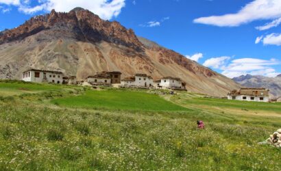
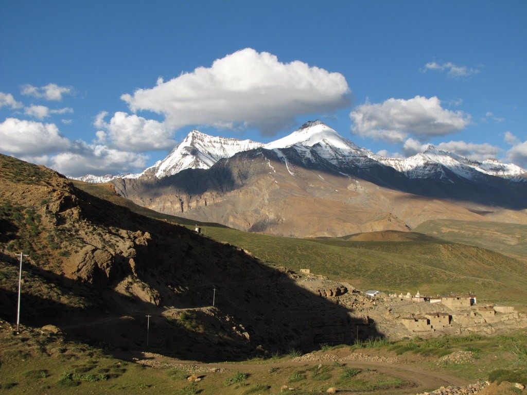
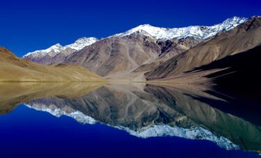
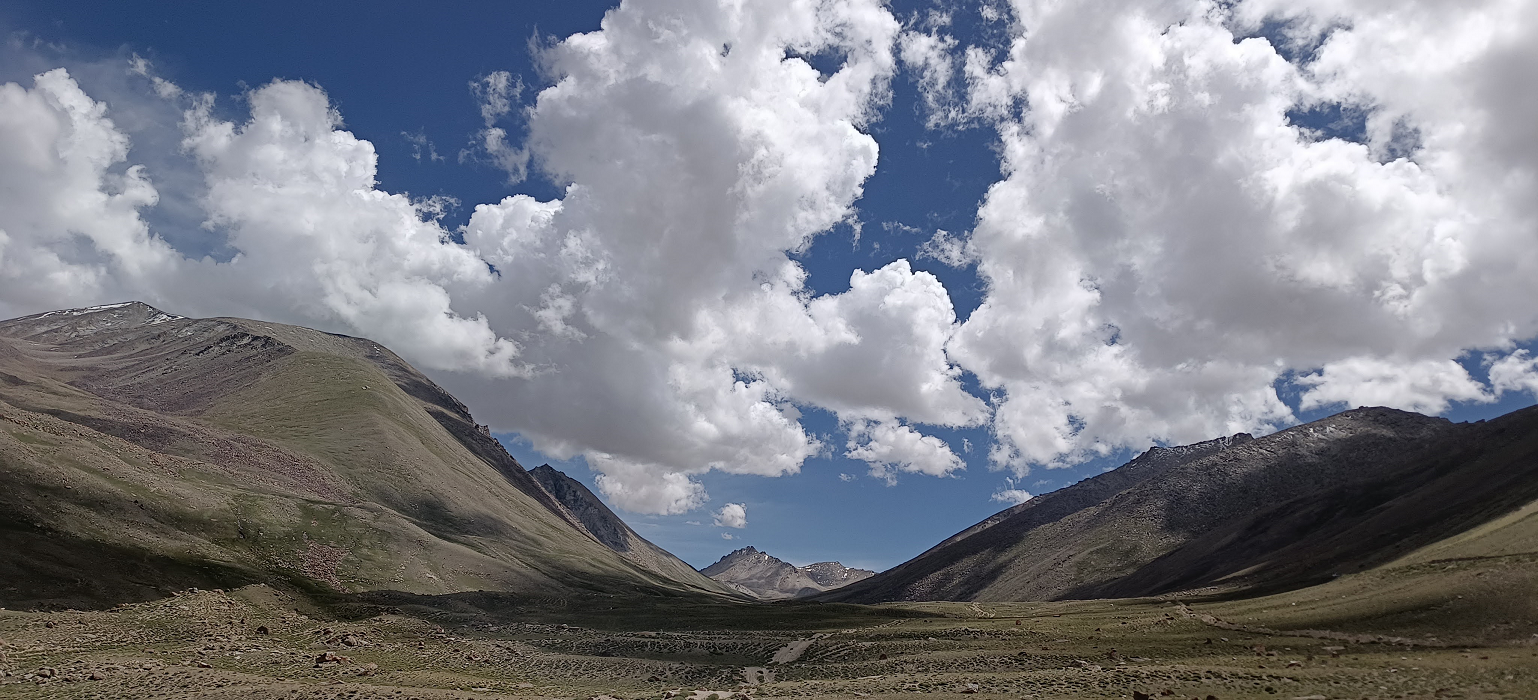
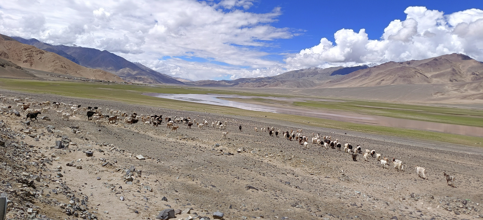
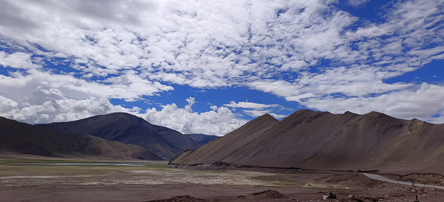
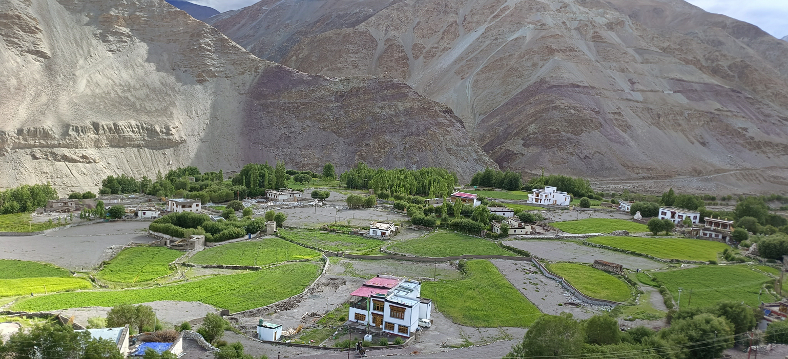
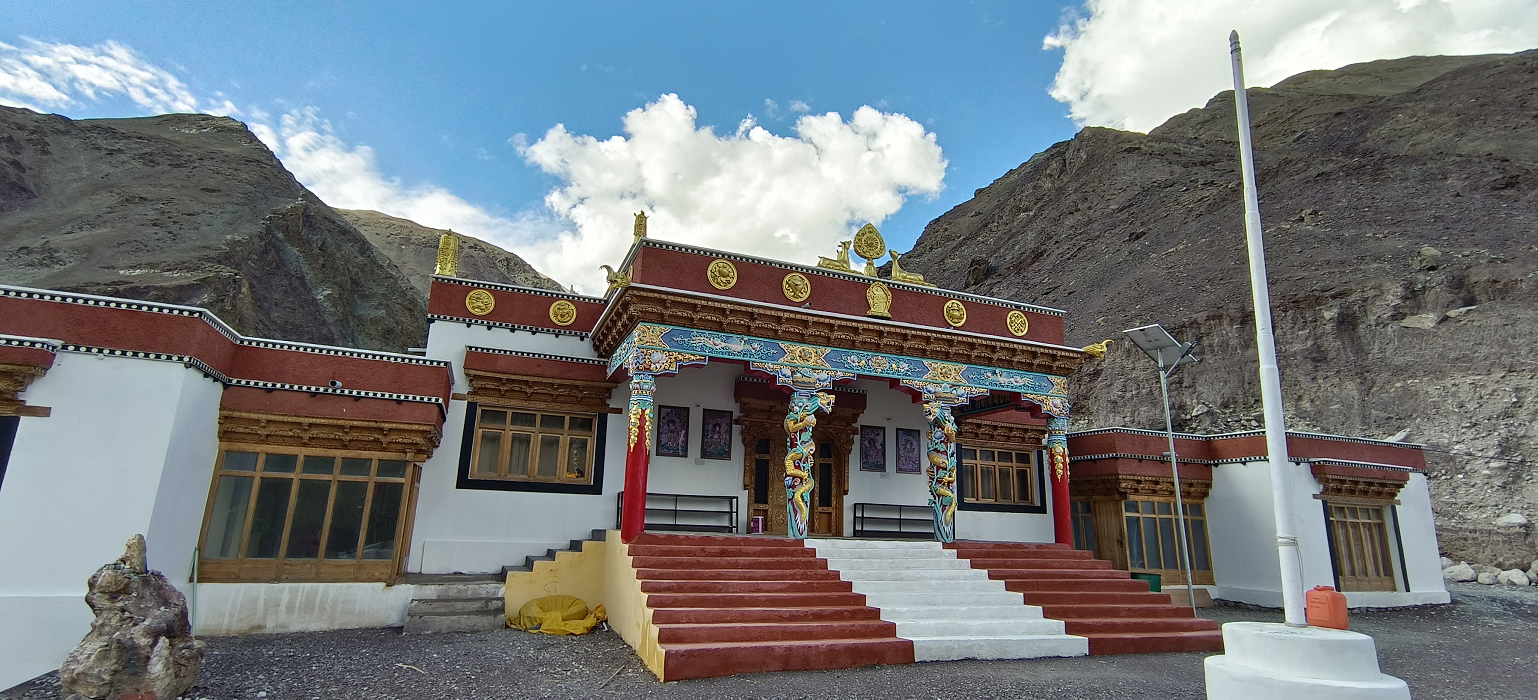
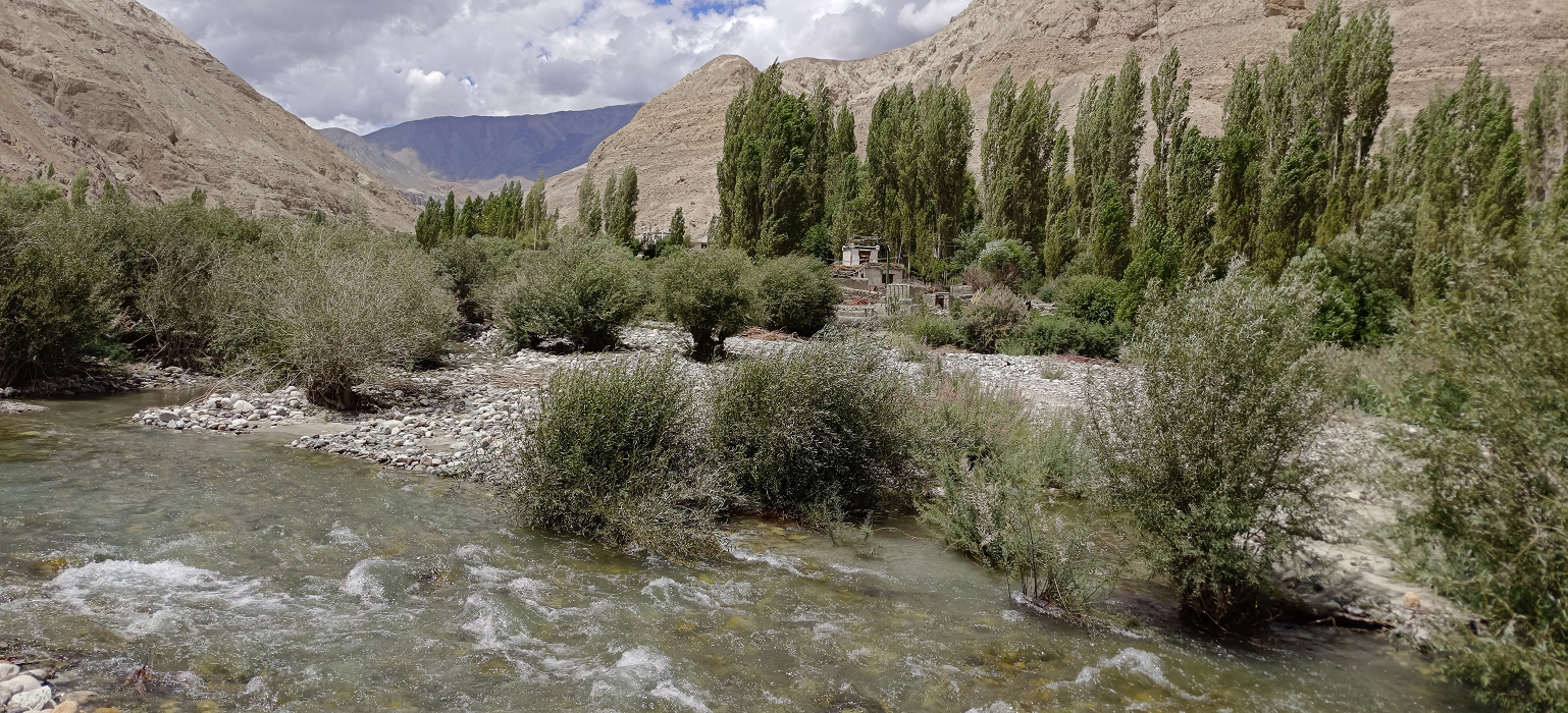
The scenery of Ladakh is dramatic – deep gorges, alluvial fans, contorted strata, large Tibetan Buddhist monasteries, flat-topped mud-brick houses in verdant oasis-like villages, snow-capped mountains and grand vistas. It is a land where real mystery still exists and is one of the most fascinating and beautiful regions of the Himalaya.
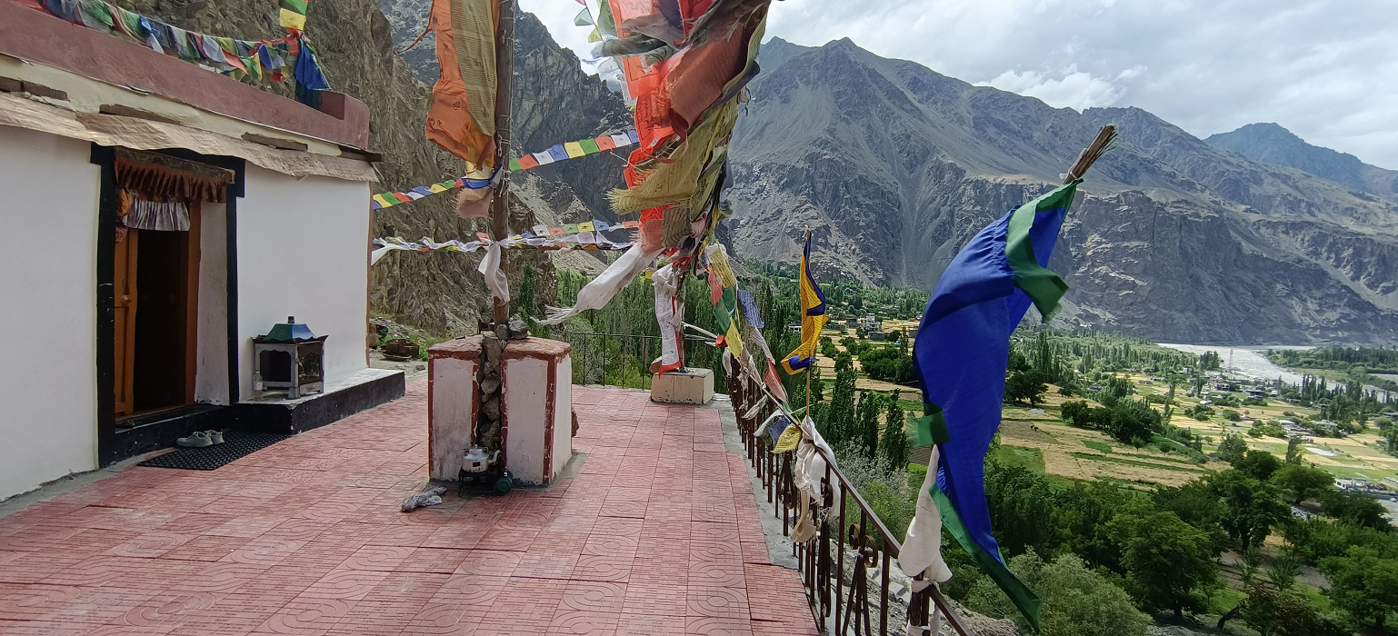
These, along with the many festivals and cultural traditions of the friendly Ladakhi people, illustrate the deep Buddhist heritage of the region.
Incredible Ladakh The Grand Circuit – 13 days Outline itinerary
Day 1: Manali – Sissu – Keylong acclimatization hike 4-5 hrs, Keylong – Jispa 3200m, 92 km, 4 hrs.
Day 2: Jispa – Shinku La 5090m – Gumbok Rangan 4330m – Kurgiakh 4150m – Hike & Explore Kyi village – Khangsar – hike to Phuktal Gonpa 3900m – Purne 3800m, 112 km, 6-7 hrs.
Day 3: Purne – Bardan Gonpa – Padum – Dzonkhul (3,890m) – Sani – Karsha 3750m –Padum 3600m, 126 km, 7 hrs.
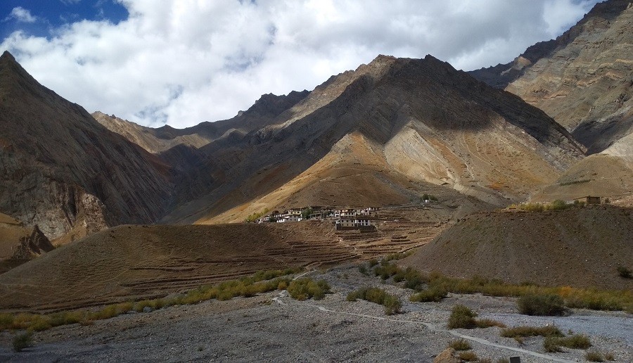
Day 4: Padum – Stongde 3800m – Zangla Fort & Zangla Nunnery – Lingshed Gonpa – Padum 3600m, 150 km, 8 hrs.
Day 5: Padum – Abran 3750m – Drang Drung glacier – Pensi La 4494m – Rangdum 4040m, 103 km, 4-5 hrs.
Day 6: Rangdum – Parkachik 3600m – Kargil (2,676m) – Mulbekh Chamba 3250m – Heniskot – Kanji 3930m – Fotu La 4109m – Lamayuru 3550m – Wanla 3150m, 242 km, 7-8 hrs.
Day 7: Wanla – Hanupatta 3800m – Sirsir La 4800m – Photoksar 4150m – Singe La 4955m – Back to Wanla, Khaltse 3000m – Alchi 3100m – Leh 3600m, 263km, 8-9 hrs.
Day 8: Leh Indus Valley Tour – Shey 3270m – Thiksey 3320m – Stakna 3320m – Hemis 3700m – Matho 3590m – Leh 3600m, 84 km, 6 hrs.
Day 9: Leh – Khardung La 5359 m – Diskit 3300 m – Hunder 3150 m, 125 km, 4-5 hrs.
Day 10: Hunder – Shyok 3700m – Tangtse 3940m – Pangong Tso 4250m – Merak 4260m, 192 km, 6-7 hrs.
Day 11: Pangong Lake Merak – Chushul 4350m – Tsaka la 4650m – Hanle 4260m, 142 km, 5-6 hrs.
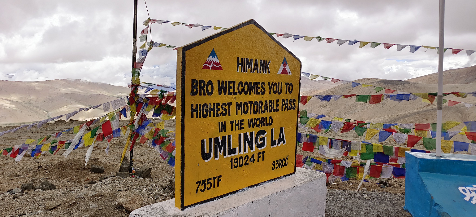
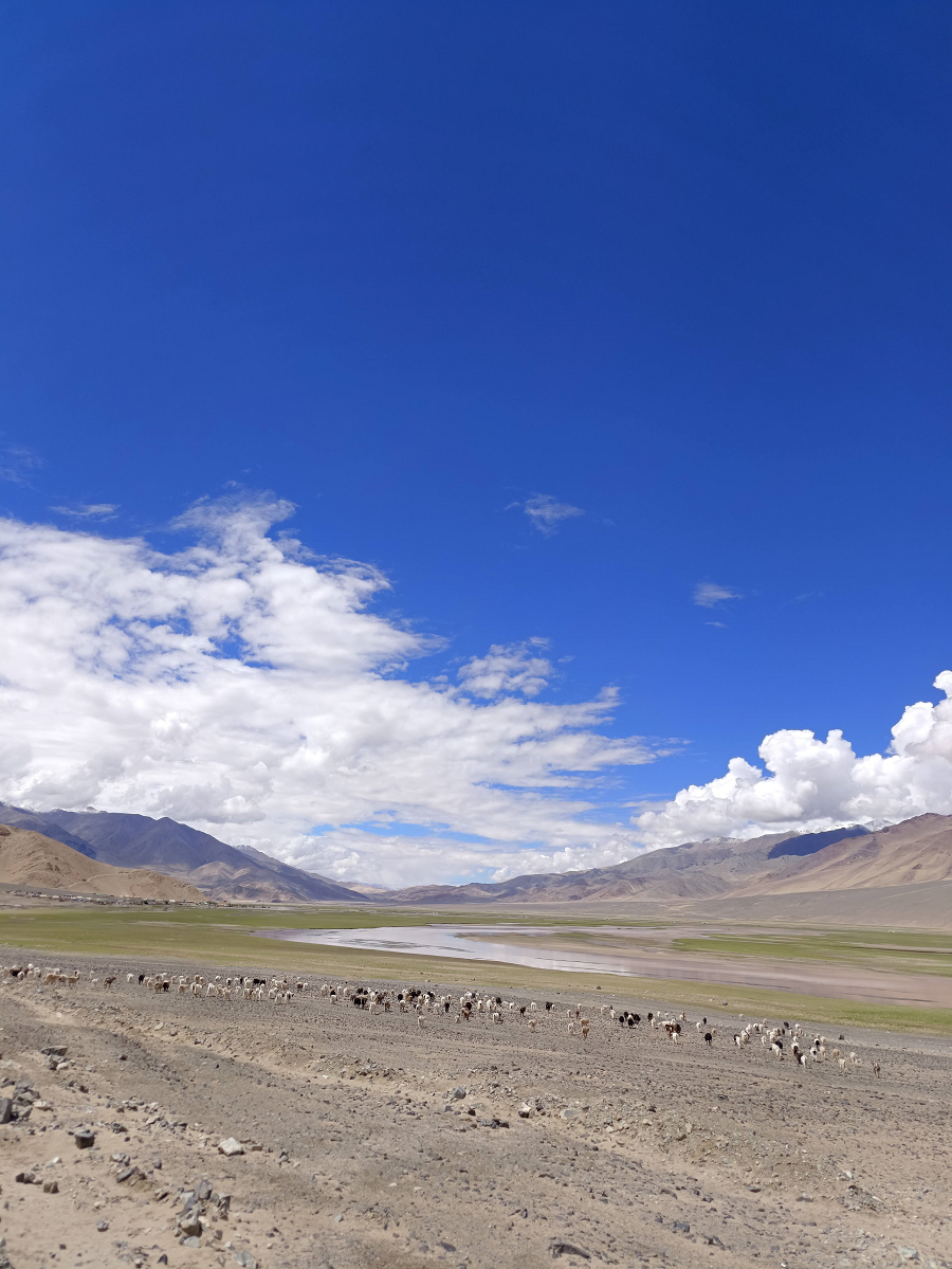
Day 12: Hanle – Norbu La 4890 – Chismule 4690m – Umling La 5798m – Koyul 4250 – Dungti 4150m – Nyoma 4180m – Mahe 4140m – Korzok Tso Moriri 4580m, 464 km, 9-10 hrs.
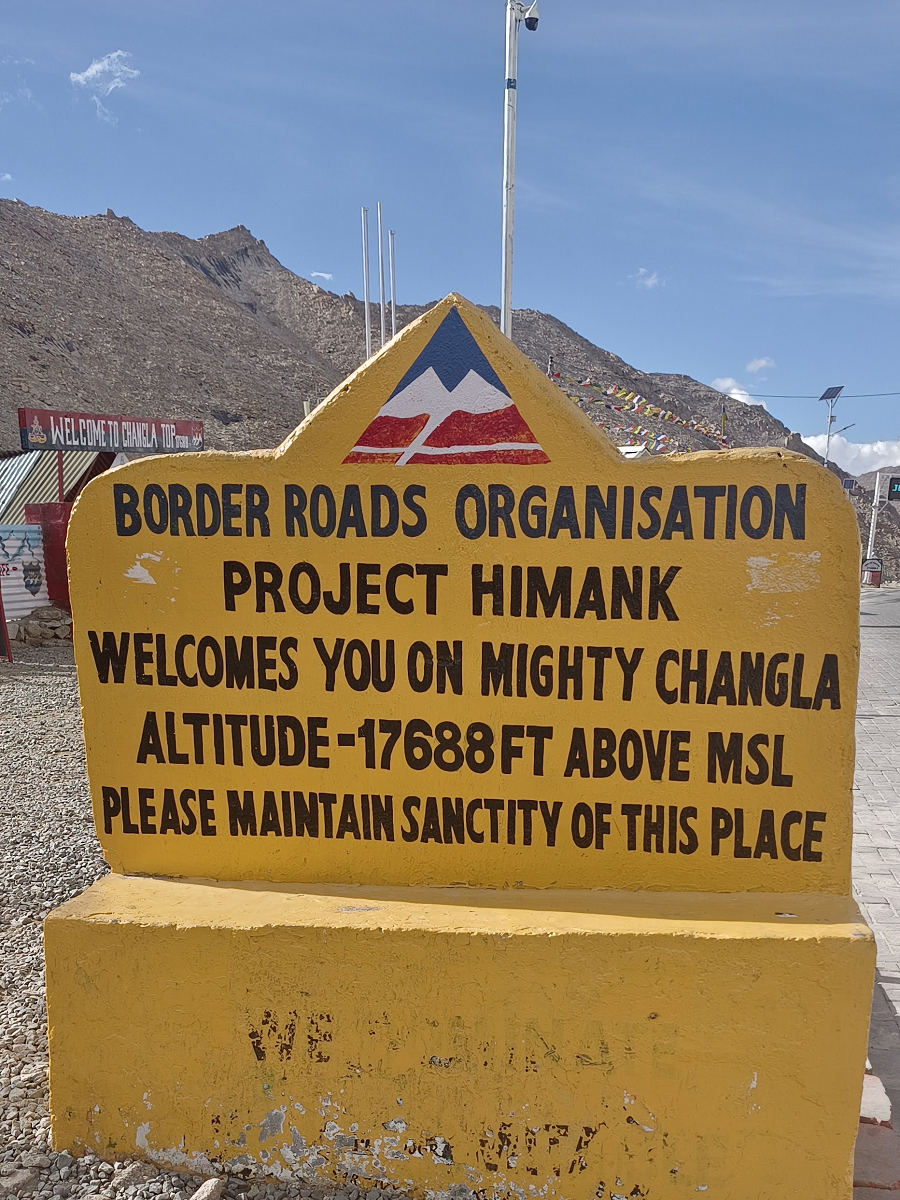
Day 13: Korzok/Tso Moriri – Puga 4400m – Thukje Tso Kar 4560 – Taglang La 5328m – Leh 3600m, 231 km, 7-8 hrs.
Option Korzok – Manali
Day 13: Korzok– Lachulang La 5059m – Baralacha La 4890m – Keylong 3100m – Manali 2050m, 395 km, 10-11 hrs.
Highlights
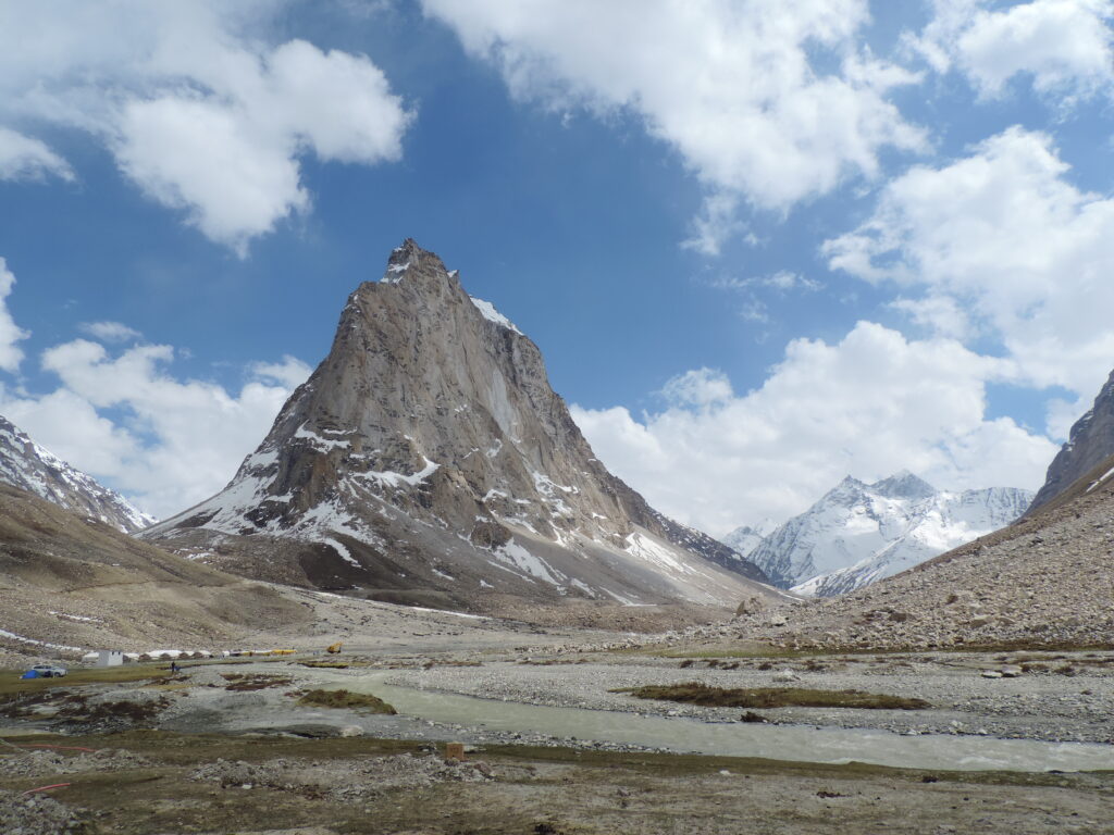
- Magnificient Gonbo Rangjon peak
- Hike to Phugtal monastery, the most spectacular sight in Zanskar
- Incredible Nubra Valley, Silk Route & Bactrian camel ride
- High Lakes of Ladakh
- Indus River valley
- Meeting with locals
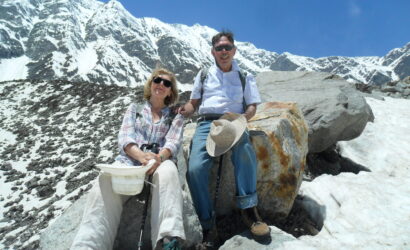
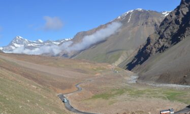
Leaving Manali first to Solang Valley and then to the Atal Tunnel, which is now the new gateway to Lahaul, Spiti, Pangi, and Zanskar Valley. The landscape changes dramatically, the greenery being replaced by barren hillsides, surrounded by high peaks, and hanging glaciers, and the village with its bountiful fields of barley, peas, and potatoes, stands out in stark contrast. Upon entering Lahaul, the Buddhist influence is evident in the numerous monasteries encountered along the way. The people here have distinct Tibetan features. From Tandi along the Bhaga River to Keylong and to Jispa, you will have an opportunity to do the acclimatization hike in Keylong before Jispa. This acclimatization hike will last for 4 to 5 hours, crossing the Bhaga River to Kardang Gonpa. Finishing the hike at Yurnad, continue driving to Jispa for an hour. Check into the hotel.
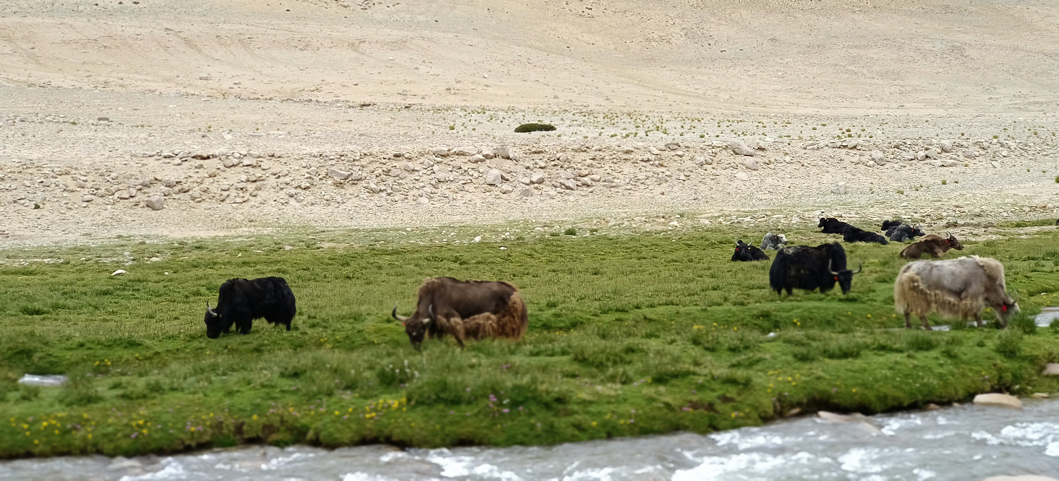
Continuing Jispa to Darcha and to Chikka & Rarik, the last two villages before Shinku La. Crossing the bridge at Palamo and then along the river to Zanskar Sumdo. Leaving Zanskar Sumdo, the road goes above the stream, following the stream that originates from Shinku La. The highest point of our trip 5,090 meters. On top of Shinku La, there are prayer flags and mani stones that tell the story of those people who crossed over years back. With an impressive view of the Zanskar side of the valley, with summits rising above 6000 m of the Great Himalayan range. The road descends to Lakhong. Lakhong is high pasture land for yaks, dzo, and sheep, where domestic animals are kept during summertime and produce cheese and butter for winter stock. Along the right bank of Kurgiakh chu and below the mass of fallen rocks of Gumbok Rangan peak. We finally arrive at Kurgiakh, the first village of Zanskar. A short hike to the most beautiful village of Kyi in the Upper Zanskar valley.
We pass the Karu, Tangze village, to a series of stupas before reaching Purne. Purne is situated at the confluence between Tsarap and Kurgiak chu and forms the Lungnak River valley.
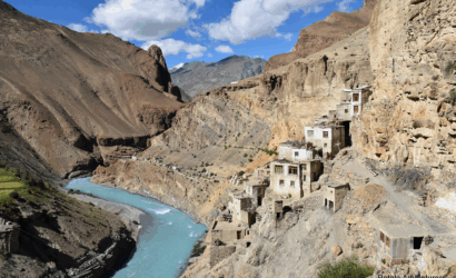
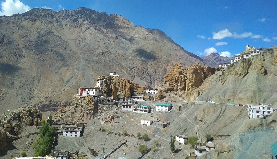
Purne to Phuktal distance: There is a road that goes along the left bank of the Tsarap River up to a wooden bridge 5 km from Purne, a hike of 2 km takes you to the most fascinating sight in Zanskar. This Phuktal monastery is built under a huge cave, and it belongs to the Gelukpa sect of Tibetan Buddhism. There is a stone tablet that serves as a reminder of the stay of Alexander Csoma de Koros at Phuktal, while he worked on the first English-Tibetan dictionary between 1826 and 1827, when he explored Ladakh.
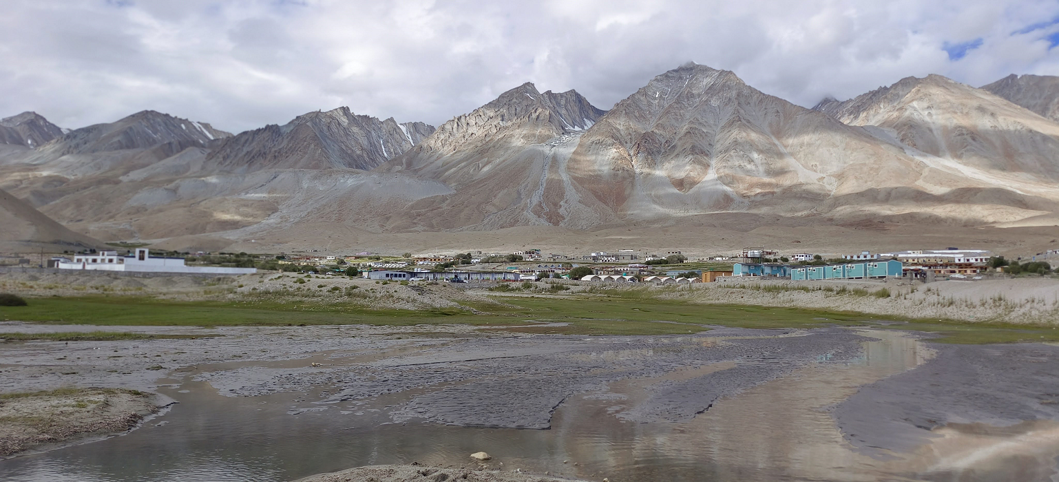
Leaving Purne to Cha village & passes through the beautiful village of Anmu, Raru & Mune, passing and visiting Bardan gompa, continue to drive to Padum and next comes the Sani gompa & Dzonkhul gompa.
Sani Gompa is considered the oldest religious site in Ladakh and Zanskar. Located approximately 6 km from Padum, it is unique for being built on flat ground rather than a cliffside. It belongs to the Drukpa Kagyu school and is the only monastery of this order in Zanskar that includes a nunnery. Kanika Stupa: The monastery's centerpiece is a 20-foot-high stupa believed to date back to the 2nd century CE during the reign of Kushan Emperor Kanishka. It is one of the 108 stupas he purportedly constructed.
Guru Padmasambhava: Said to have meditated for five years in a small chapel known as 'Gamshot Lhakang'. Yogi Naropa: An eminent Indian scholar believed to have meditated under the Kanika Stupa. A small room next to the stupa houses a veiled bronze statue of him. Unique Architecture: Unlike typical Zanskari monasteries, Sani is built in a fortress-like rectangular shape on the central plain. It is surrounded by a rare plantation of ancient poplar trees. Holy Cremation Ground: Outside the complex lies one of the eight most important cremation grounds for Tibetan Buddhists, ringed with ancient rock carvings showing Indian influence.
Sani Naro Nasjal: Held in late July or early August (typically the 15th to 20th of the sixth Tibetan month). For 2026, the festival is scheduled for July 28–29. Naropa Statue Unveiling: The veiled bronze statue of Naropa is unveiled for public blessing only once a year during this festival.
Cham Dances: Monks from Bardan Monastery perform ritual masked dances. Uniquely, the festival also features dances performed by newlywed brides from the village.
Nungnes: A fasting ritual usually taking place in July
Dzongkhul Monastery is a renowned cave monastery in the Stod valley of the Zanskar region in Ladakh, India. Built into the side of a sheer rock cliff in the Ating gorge, it is one of the most sacred and ancient monastic sites in the region. The monastery is built around two natural caves where the celebrated Indian Buddhist yogi Naropa (956–1041 CE) is believed to have meditated. Dzongkhul belongs to the Drukpa Kagyu sect of Tibetan Buddhism. The foundation is believed to be over 1,000 years old, with the current structures often described as being around 1,000-1200 years old.
Frescoes and Art: The caves contain ancient frescoes and murals, including works by the famous 17th-century painter and scholar, Zhadpa Dorje.
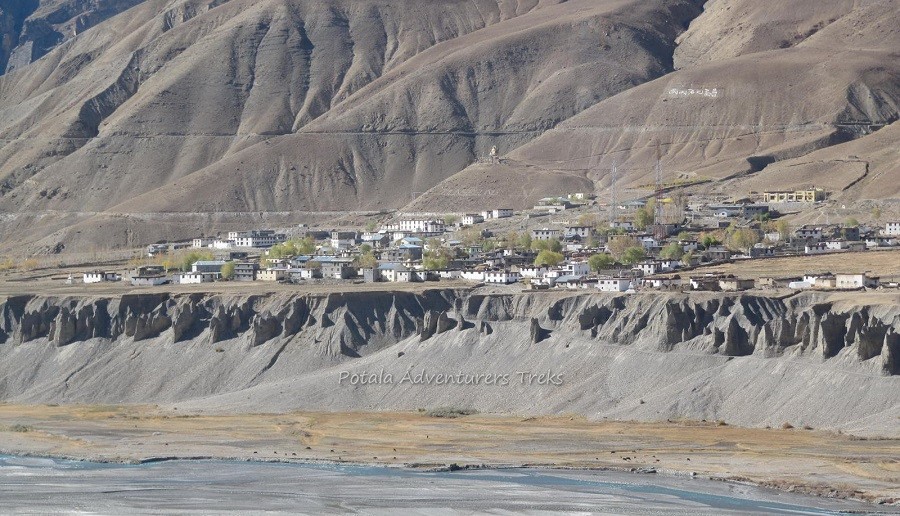
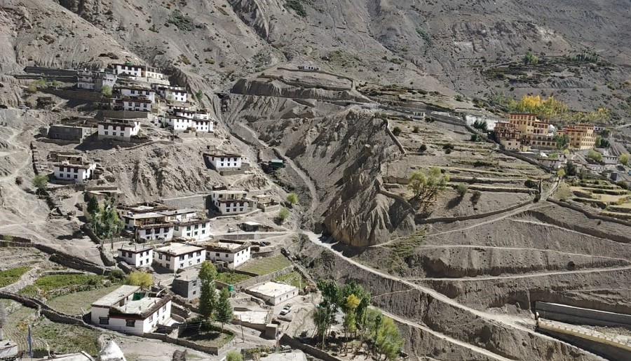
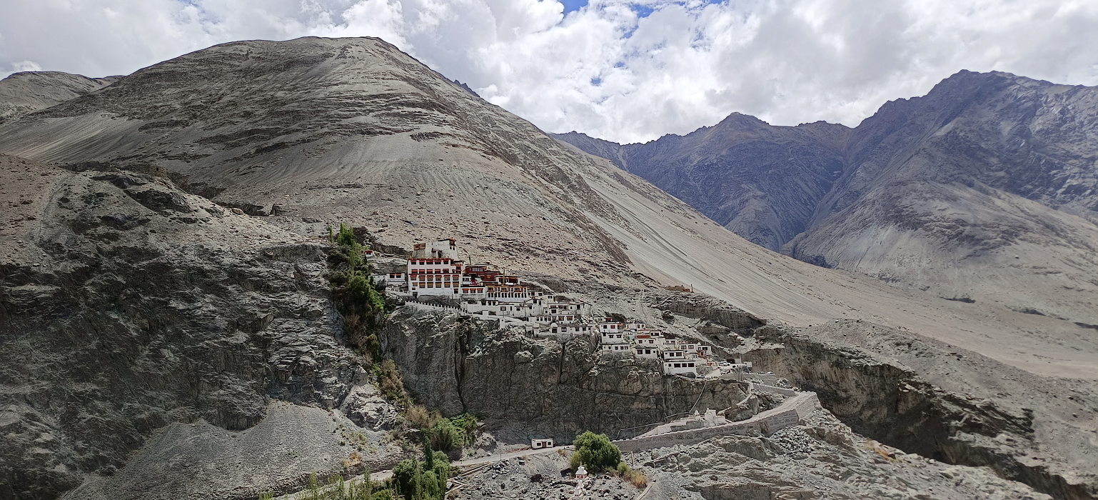
Back to Padum to visit the major attractions in Central Zanskar. At the first visit to Karsha monastery. Karsha is one of the biggest monastic complexes in the Zanskar region.
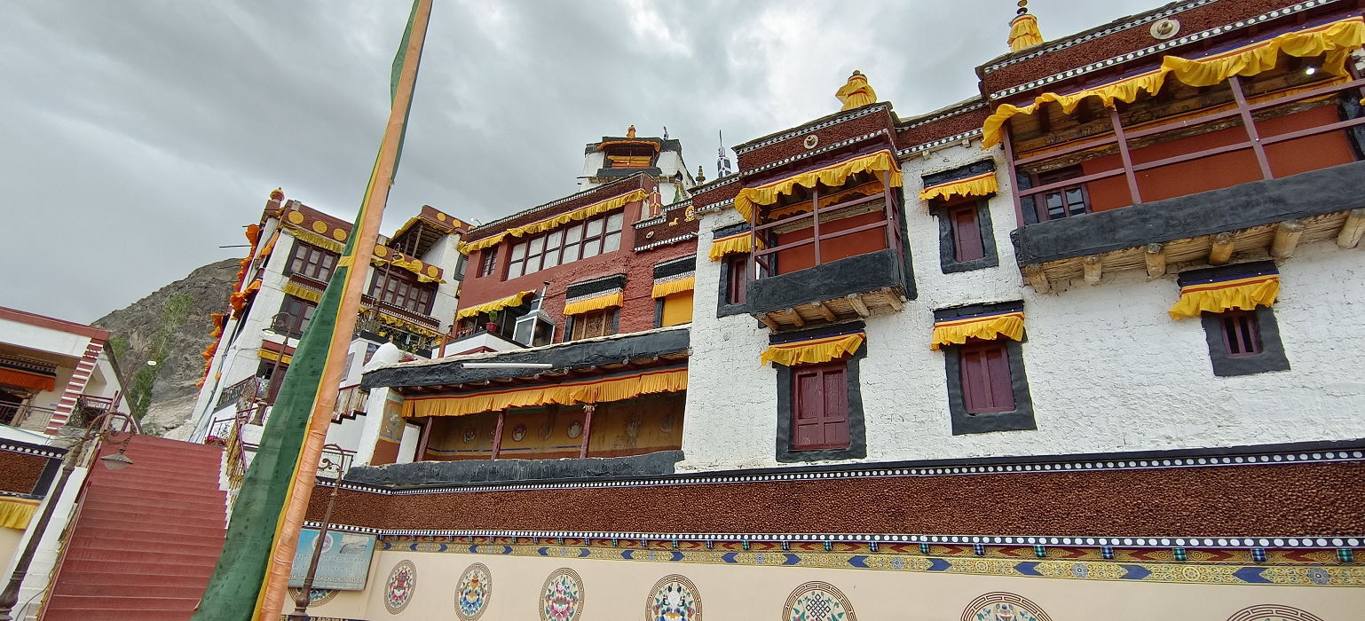
Karsha Gompa is the largest and most important monastery in Zanskar. Perched dramatically on a steep hill overlooking the Padum Valley and the Zanskar River, this 10th-century complex functions as a major scholastic and spiritual hub for the region.
Fortress-like Architecture: The monastery is built in a stepped, cliff-clinging style traditional to Tibetan architecture, housing residential quarters for about 100 monks.
Ancient Art: It contains murals and thangkas that are over 900 years old, including exquisite paintings by the master artist Lama Dzadpa Dorje.
Sacred Relics: The monastery preserves the bone relics of Dorje Rinchen and a silver-crowned statue of Lhaso Cho Rinpoche brought from Lhasa in the 1960s.
Chuk-shik-jal Temple: The oldest structure within the complex, dedicated to Avalokiteshvara, featuring wall paintings linked to the era of the great translator Rinchen Zangpo (958–1055 CE).
Karsha Gustor: This is the most significant annual event, celebrated to mark the victory of good over evil.
2026 Dates: The festival is scheduled for 12–13 July 2026.
Activities: Monks perform sacred Cham (masked) dances and the "Black Hat Dance," accompanied by traditional music and community prayers.
Spiritual Leadership: The monastery is under the control of the younger brother of His Holiness the Dalai Lama.
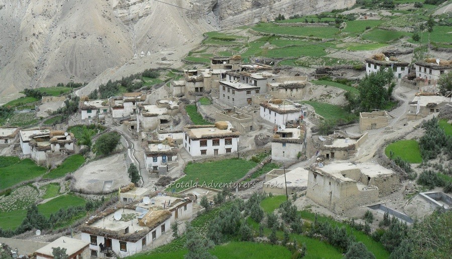
Leaving Padum to Thongde, which is built on a hilltop by Lama Marpa and is more than 950 years old, finally drive to visit Zangla Fort. Just above Zangla village, there is a Nunnery that is home to a small community of nuns. The nunnery is a peaceful retreat, offering visitors a chance to experience the spiritual and simple life led by the nuns. Zangla Nunnery is known as
Changchub Choling monastery, Zangpa, since 1989. Funds have been used to build a classroom, provide food for the nuns, and pay teachers’ salaries. A teacher in the village helps the nuns keep their accounts.
18 nuns are living in the monastery and 15 novices are living at home who come during the day. Of the 18 nuns living in the monastery, 6 are under 30 and 3 are over 50. The youngest nun is 12 years old, and the oldest is 78. One young nun related that her mother died and her elder sister is disabled and cannot work. She has 3 younger sisters and brothers. She lives at home and comes to the monastery daily for studies. https://www.jamyang.org/pages/changchubcholing.php
Continue to Lingshed Monastery is a Gelugpa Buddhist monastery in Ladakh. It is located near Lingshet village. It is 84 km north of Padum. It was founded in the 1440s by Changsems Sherabs Zangpo, disciple of Je Tsongkhapa, on a monastic site previously founded by the Translator Rinchen Zangpo. The monastery has belonged to the religious estate of Ngari Rinpoche since 1779. The Jangchub Tensung Dorje Center was founded in Lingshed by Kyabje Dagom Rinpoche in 1994.
In 1779, the Ladakhi king Tsewang Namgyal donated the lands of Lingshed and its surrounding villages (along with the Zanskari monasteries and villages of Karsha, Mune, Phuktal and Rangdum) to Lobsang Gelek Yeshe Dragpa, the 3rd incarnate of the Ngari Rinpoche lineage. In 1783, Ngari Rinpoche founded Rangdum Monastery on the boundary of the Karsha Valley as his ecclesiastical seat, to which Lingshed is subordinate. Finally back to Padum.
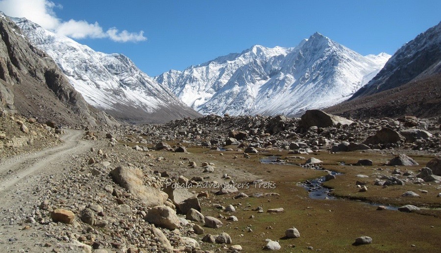
Leaving Padum today, we drive to the Upper Stod valley along the Stod River to Pensi La, and pass many small villages along the route to Pensi La.
Pensi La, also spelled Penzi La, is famously known as the "Gateway to Zanskar." Situated at an elevation of approximately 4,400 metres (14,436 feet), this high-altitude mountain pass connects the Suru Valley in Kargil to the remote Zanskar Valley. It lies roughly 150 km south of Kargil and about 25 km from Rangdum Monastery. The pass is the primary entry point for travellers heading from Kargil to Padum via the NH-301 highway.
The pass acts as a watershed; to the west flows the Suru River (a tributary of the Indus), while the eastern flank gives rise to the Doda (Stod) River, which eventually forms the Zanskar River.
Drang-Drung Glacier: Visible directly from the roadside, this is the most famous sight at Pensi La. It is one of the largest glaciers in Ladakh, stretching about 23 km in length.
Two high-altitude lakes, Stat Tso and Lang Tso, are located near the summit and can be reached via a short walk from the road.
After visiting the Penzi La, drive to the Rangdum plains.
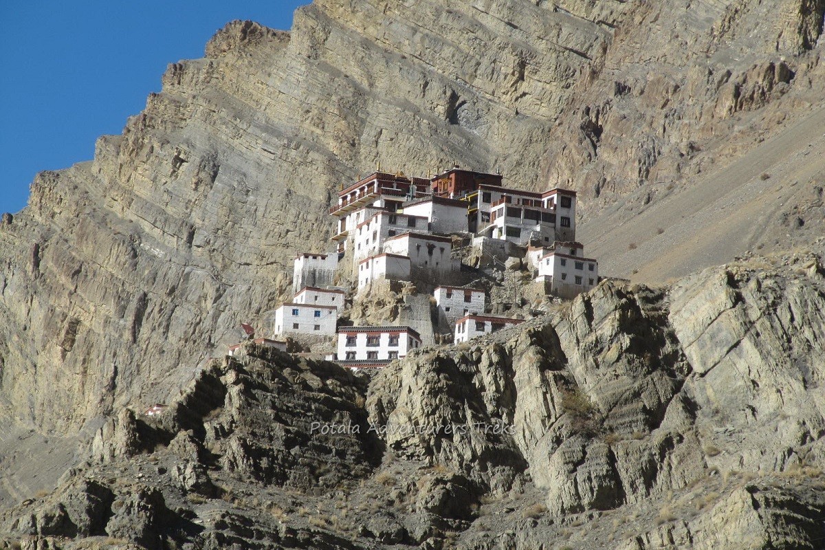
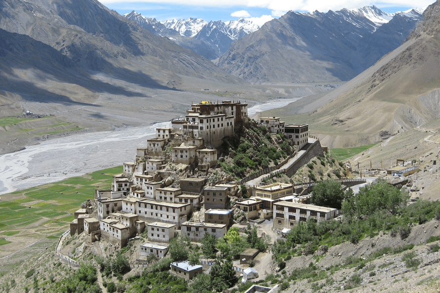
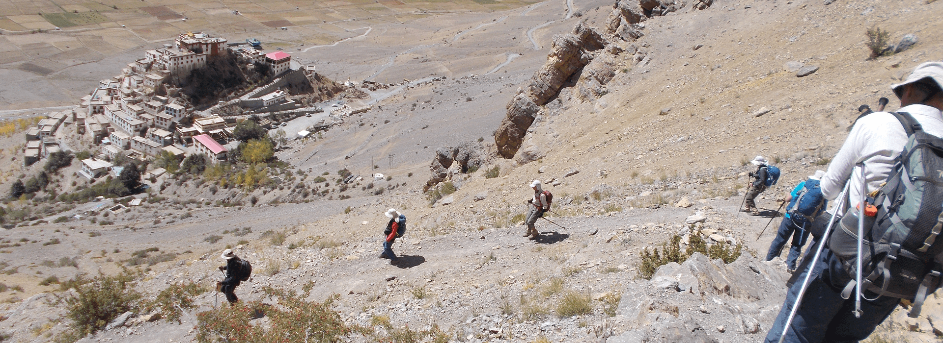
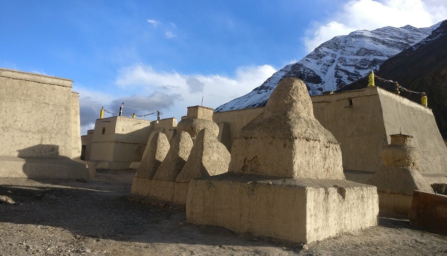
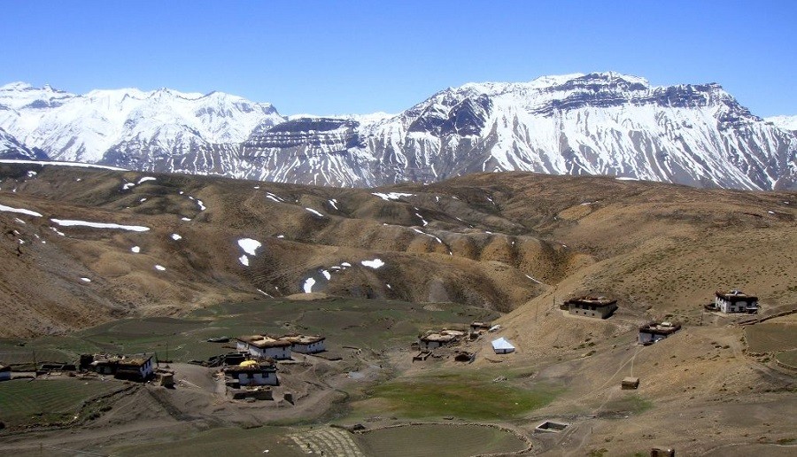
Rangdum is a remote high-altitude plateau in the Kargil district of Ladakh, famously serving as the halfway point between Kargil and Padum. At an elevation of approximately 3,657 metres (11,998 feet), it is the last inhabited spot in the Suru Valley and serves as a cultural bridge between the predominantly Muslim Suru Valley and the Buddhist Zanskar region.
The focal point of the area is the 18th-century Rangdum Monastery, a Tibetan Buddhist site belonging to the Gelugpa (Yellow Hat) sect.
Perched on a steep, sugarloaf-shaped hill at 4,031 metres (13,225 feet).
The fortress-like complex houses a central prayer hall with an impressive collection of Tibetan antiques, ancient thangkas, and a 7-metre-high statue of Maitreya Buddha.
It is home to about 30–40 monks who rely on offerings from the nearby villages of Julidok and Yuldo.
The Archaeological Survey of India (ASI) has considered declaring it a monument of national importance to protect its unique cultural heritage.
Leaving Rangdum today after breakfast, we drive to Parkachik.
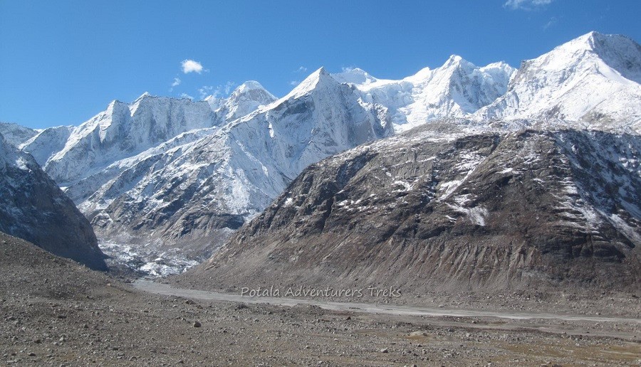
Parkachik is a picturesque village and high-altitude attraction in the Suru Valley, located approximately 90 km from Kargil on the route to Zanskar. It is widely celebrated for the Parkachik Glacier, a massive river of ice that descends from the slopes of the Nun Kun massif.
Parkachik Glacier: This 14-km-long glacier flows within meters of the NH 30, making it one of the most accessible glaciers in Ladakh. Visitors can walk across a suspension footbridge over the Suru River to reach its snout.
The Dardi tribe inhabits the village and maintains a peaceful Islamic vibe. It is characterized by lush green fields and traditional stone houses, contrasting with the typical desert landscape of Ladakh.
Parkachik Glacier View Point: Offers extraordinary, up-close views of the massif and the massive Parkachik Glacier that descends from it.
The Nun Kun massif is a massive mountain range in the Zanskar region of Ladakh, northern India. It is famous for its twin peaks, Mount Nun and Mount Kun, which are among the highest in the Indian Himalayas.
The Twin Peaks and Beyond
Mount Nun, standing at 7,135 m (23,409 ft), is the highest peak in the massif and the tallest point in Jammu and Kashmir. It is known for its steep walls and technically demanding slopes.
Mount Kun: At 7,077 m (23,219 ft), it is slightly lower and offers a broader, more gradual approach.
Pinnacle Peak: The third-highest point of the massif, reaching 6,930 m (22,740 ft).
Glacial Plateau: A 4 km-long snowy plateau separates Nun and Kun, making joint expeditions a popular goal for mountaineers.
Mount Kun was first summited in 1913 by an Italian team led by Mario Piacenza.
Mount Nun was first conquered in 1953 by a Swiss-French-Indian team; notable climber Claude Kogan was among the first to reach the summit.
Passing through the beautiful Suru Valley to Kargil. You continue to join the Srinagar – Leh highway and take this road to Lamayuru, passing through Mulbek, Chamba, and Fotu La small pass.
Suru Valley is a breathtaking, high-altitude region in the Kargil district of Ladakh, India. Known as the "granary of Ladakh," it is surprisingly fertile and green compared to the region's typical arid, "moon-like" landscapes. It serves as a natural gateway from Kargil to the remote Zanskar Valley.
Kartse Khar: An ancient village famous for a 7-foot rock-carved Buddha statue dating back to the 7th or 8th century, reflecting the region's early Buddhist history.
The inhabitants are primarily of Tibeto-Dard descent and predominantly follow Shia Islam, though the upper valley around Rangdum remains Buddhist.
Mulbekh Chamba Statue (~40 km from Kargil): A 9-metre high Maitreya Buddha statue carved into a solid rock face, dating back to the 8th century.
Fotu La View Point: Offers a panoramic "zigzag" view of the highway and deep Himalayan valleys, perfect for photography.
Moonland View Point: Just before reaching Lamayuru, the landscape transforms into a surreal, yellowish-grey cratered formation that resembles the lunar surface.
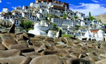
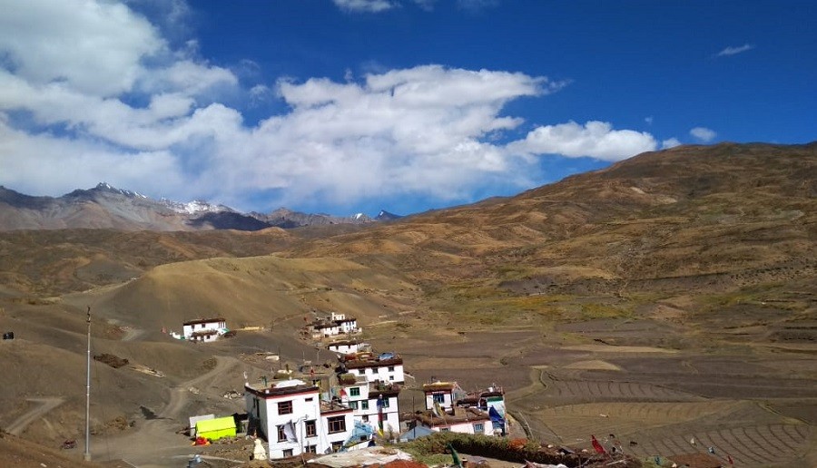
Lamayuru Monastery: One of the oldest and largest monasteries in Ladakh, perched dramatically on a hilltop overlooking the "Moonland."
The drive from Lamayuru to Wanla is a short but scenic journey of approximately 15–22 km that takes about 40 minutes to complete. While this route is traditionally a popular day trek, a motorable road now connects the two villages, serving as the starting point for the newer road toward Zanskar (Padum)
Key Highlights in Wanla
Wanla Monastery: A 900-year-old gem that is less crowded than Lamayuru. It is famous for its three-story image of Avalokitesvara and ancient murals that are significantly older than those in most other Ladakhi monasteries.
Castle Ruins: You can see the remains of an ancient fortress perched on the ridge above the village.
Shilla Village: A picturesque hamlet located just before Wanla, known for its lush orchards that contrast sharply with the surrounding barren mountains.
The drive from Wanla to Singe La is a segment of the adventurous "shortcut" route between Lamayuru and Padum. From Phenji La to Hanupatta road passes through a deep canyon, which is impressive to watch. The pass typically remains snowbound and closed to civilian traffic, with standard seasonal openings usually occurring in late May or early June. Approximately 75 km (from Wanla village to the summit of Singe La), between 3 and 4 hours, though the total journey from Wanla to Padum can take 8–10 hours due to the extremely rough terrain.
Photoksar is a remarkably isolated and picturesque village in Ladakh, situated at an altitude of 4,200m/13780 ft. Known for its unique location between two high altitude passes, Sirsir La and Singe La, it serves as a critical stopover on the off-road route between Lamayuru and Padum.
After finishing this route back to Wanla and join the Sri Nagar – Leh highway and drive to the Alchi monastery.
Alchi monastery, or Alchi Gonpa or Alchi Choskhor, is one of the oldest and most artistically significant religious sites in Ladakh. Located about 65–70 km west of Leh, it is uniquely situated on flat ground along the banks of the Indus River, rather than on a hilltop like most other Ladakhi gompas.
Unlike the predominantly Tibetan style of later monasteries, Alchi reflects a rare Indo-Kashmiri influence in its intricate wood carvings and vibrant wall paintings.
It houses some of the oldest surviving paintings in Ladakh, dating back over 1,000 years to the 10th or 11th century.
Three Main Shrines:
Dukhang (Assembly Hall): The largest and oldest part of the complex, featuring preserved wooden doorframes and mandalas painted on the walls.
Sumtseg (Three-Tiered Temple): A three-story structure known for its massive clay statues of Bodhisattvas (Maitreya, Avalokiteshvara, and Manjushri) that extend through two floors.
Manjushri Temple: Known for its four-armed statues of Manjushri and unrefined but historically significant frescoes. Finally, continuing a 2-hour drive to Leh for the end of the trip.
Indus Valley East (Monastery Circuit)
This is a popular one-day tour from Leh, covering approximately 90–100 km round trip.
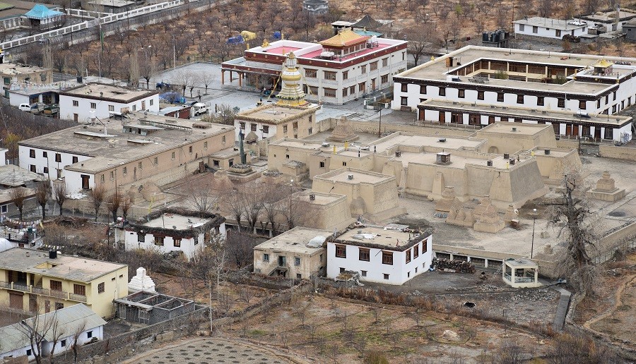
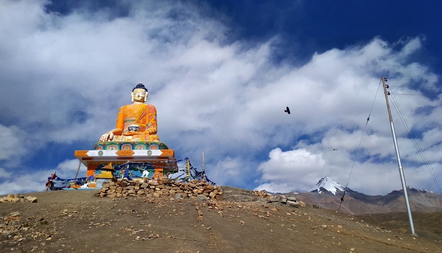
Shey Palace & Monastery, the ancient summer capital of Ladakh, is famous for its 12-metre-high copper-gilded Shakyamuni Buddha statue.
Thiksey monastery is often called the "Mini Potala" due to its resemblance to the Potala Palace in Lhasa, Tibet. It houses a 15-metre-tall statue of Maitreya Buddha.
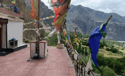
Hemis gonpa the largest and wealthiest monastery in Ladakh, is tucked away in a gorge. It is the spiritual centre of the Drukpa lineage.
Stakna Gonpa, perched atop a hill shaped like a "tiger's nose," offers 360° views of the Indus Valley.
Stok Museum, the current residence of the Ladakhi royal family, features a museum with royal artefacts, crowns, and 16th-century thangkas.
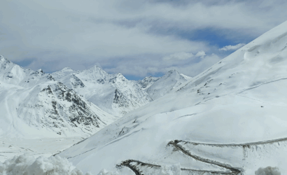
The drive from Leh to Hunder covers approximately 125 km and typically takes 4–6 hours. The journey is famous for crossing Khardung La, once widely considered the world's highest motorable pass at 17,582 ft (5,359 m). Road Conditions: Generally paved but can be rough and slushy near the summit.
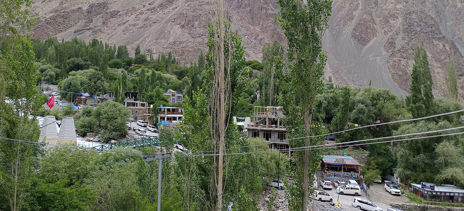
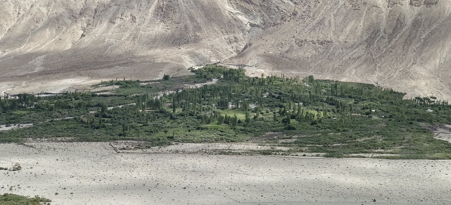
Nubra Valley is a high-altitude cold desert in Ladakh, north of Leh, famous for its unique landscape where dunes sit alongside snow-capped peaks. Known historically as Ldumra (the "Valley of Flowers"), it was a vital stop on the ancient Silk Route. At an average altitude of 10,000 feet, it is lower than Leh, making it an excellent spot for acclimatisation early in your trip.
Top Attractions & Activities
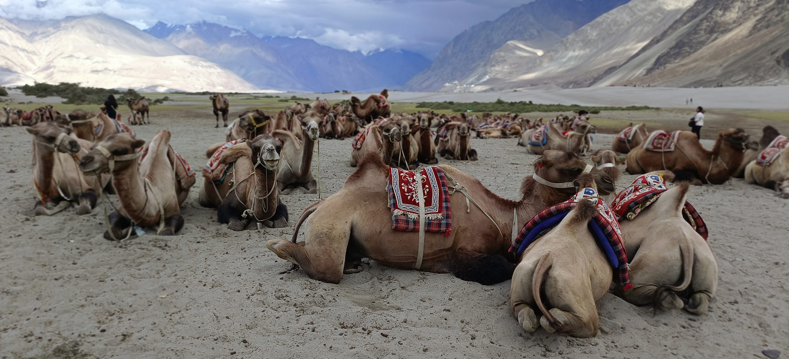
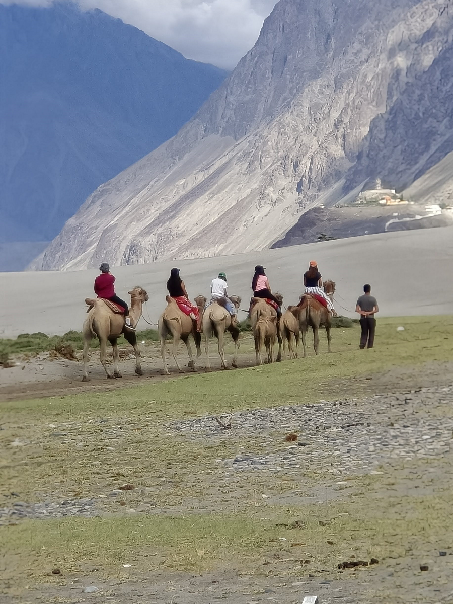
Hunder Sand Dunes: Home to the rare, double-humped Bactrian camel ride.
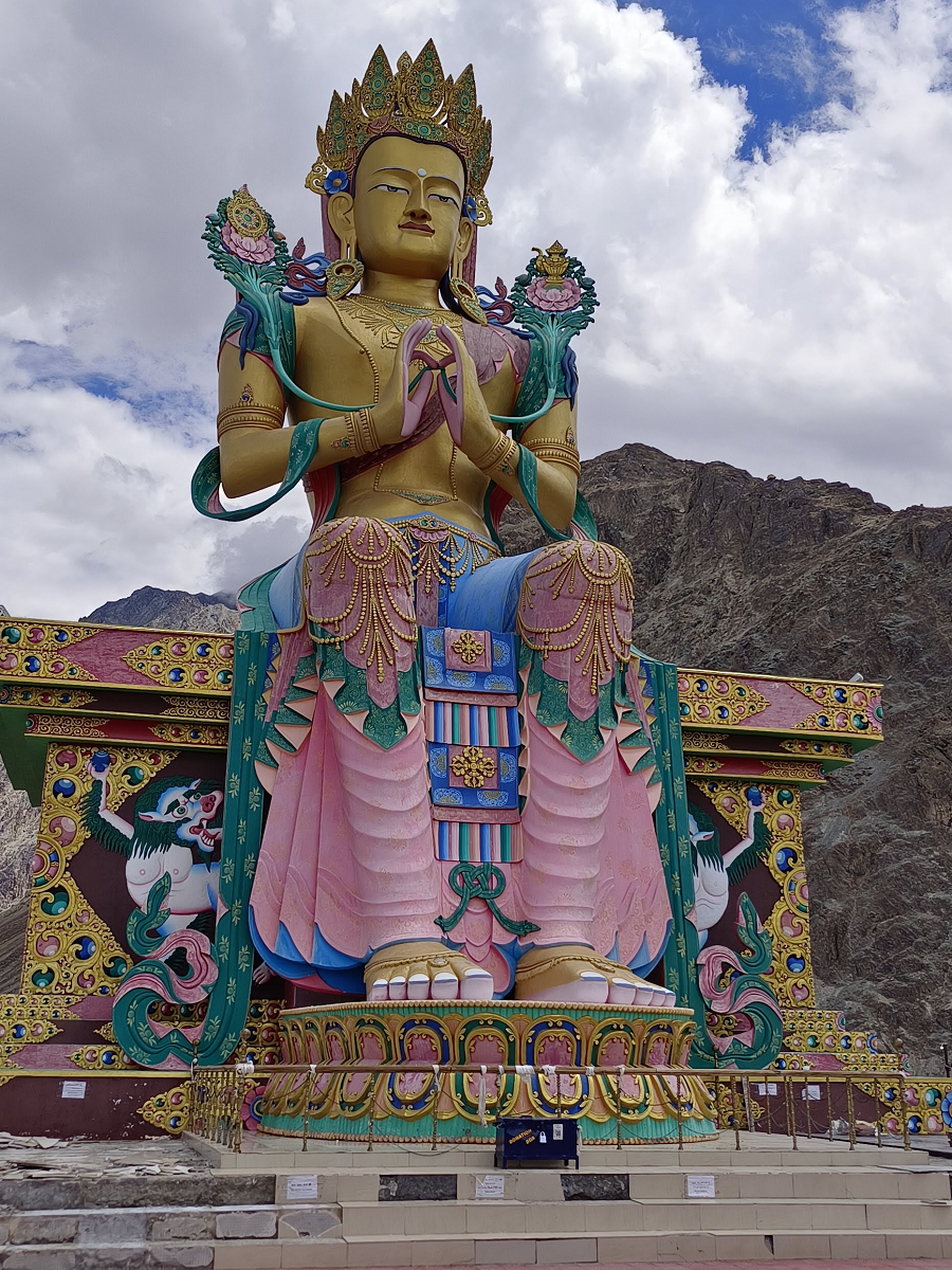
Diskit Monastery: The valley’s oldest and largest monastery, featuring a landmark 106-foot-tall Maitreya Buddha statue with panoramic views.
Turtuk Village: A culturally distinct Balti village reclaimed from Pakistan in 1971. It is famous for its lush apricot orchards and views of the Karakoram range.
Panamik Hot Springs: Natural sulphur springs believed to have medicinal properties.
Best Time to Visit: May to September is peak season for pleasant weather. April is ideal for seeing apricot blossoms, though it can still be chilly.
Foreign Tourists: Still require a Protected Area Permit (PAP), usually applied for in groups of two through registered travel agents.
The drive from Hunder to Merak at Pangong Lake covers approximately 192 km and typically takes 6–8 hours. This journey is a popular direct route that connects the Nubra Valley to the far end of Pangong Tso without having to return to Leh.
Hunder to Agham 45 km, you will drive back towards Leh, but turn left at Khalsar towards Agham village. Agham to Shyok Village, 50 km, this stretch follows the Shyok River. It is scenic but can be unpredictable due to potential river overflows or landslides. Shyok to Durbuk/Tangtse 35 km, the road climbs away from the riverbed and merges with the main Pangong highway at Durbuk. Tangtse to Merak km, after reaching the Pangong Lake shore at Lukung, you will drive along the lake, passing Spangmik and Man villages to reach Merak.
Terrain: The road past Spangmik toward Merak is largely a dirt track (Kaccha road) with sand, gravel, and occasional water crossings. Unpredictability: During peak summer (July–August), the Shyok River route can sometimes be closed due to high water levels. In such cases, the much longer & Wari La route is used as an alternative, but takes more time.
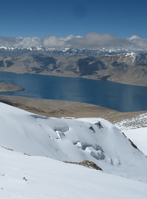
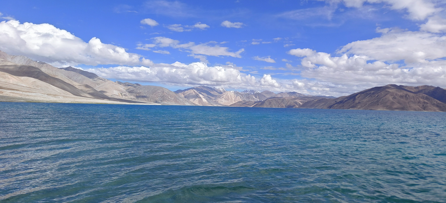
Pangong Tso is a breathtaking endorheic (landlocked) lake situated at an altitude of approximately 14,270 ft (4,350 m). Extending 134 km from India into Tibet, it is famous for its crystal-clear water that changes hues from deep blue to turquoise throughout the day.
Foreign Tourists: A Protected Area Permit (PAP) is still required and must usually be arranged through a registered travel agent in Leh for groups of at least two people.
Best Time to Visit: May to September offers pleasant daytime temperatures. The lake is typically frozen from January to March.
Lukung: The entry point of the lake where most "day-trippers" stop for photos.
Spangmik: The most commercialised hub with numerous luxury lakeside camps and tents.
Maan & Merak: These villages offer a more serene, offbeat experience with homestays, ideal for those arriving via the direct route from Nubra Valley.
Stargazing: Due to the thin air and lack of light pollution, it is a premier spot for seeing the Milky Way.
Wildlife Spotting: Look for marmots (often found near the road to the lake), migratory Bar-headed Geese, and Brahminy Ducks.
The drive from Merak to Hanle is one of the most remote and scenic stretches in Ladakh, covering approximately 142 km and taking about 5–6 hours. This route runs very close to the Line of Actual Control (LAC) and is generally permitted only for Indian nationals. The most popular path is the direct route via Chushul. Merak to Chushul is 28 km, a rough, sandy dirt track running along the southern shore of Pangong Lake. High ground clearance is essential as you may encounter deep sand and quicksand zones. Chushul to Rezang La 12 km, a must-visit stop to pay respects at the Rezang La War Memorial, commemorating the 1962 battle. Rezang La to Tsaga La 19 km, cross the Tsaga La (15,200 ft), which marks the transition into the Hanle valley. Tsaga to Loma 43 km, the road improves significantly after Tsaga village. At Loma, there is a major army checkpost where you must register and present your permits. Loma to Hanle 51 km, A smooth, well-tarred road that allows for faster travel to your final destination.
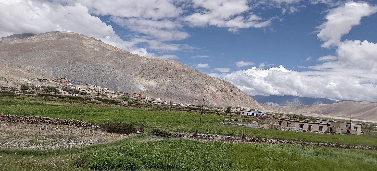
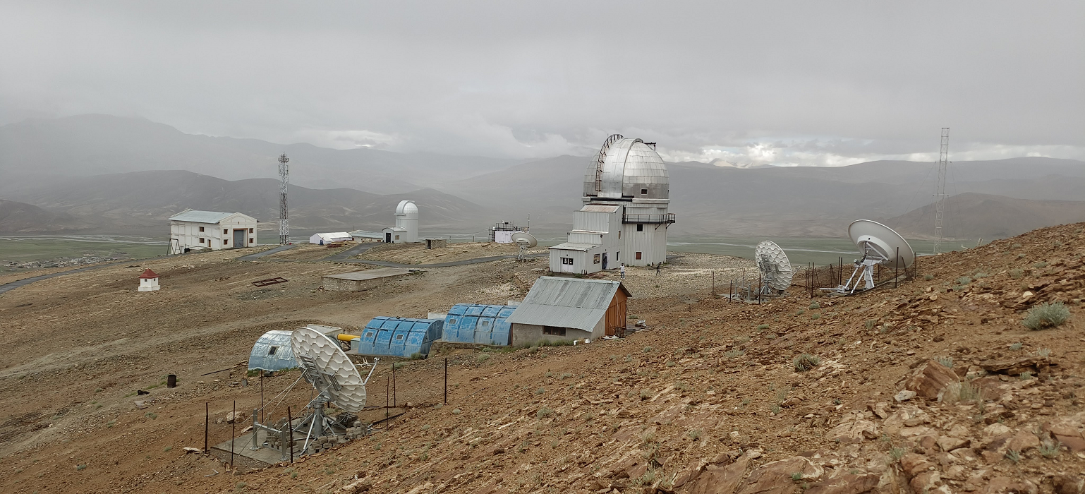
Hanle is a remote, high-altitude village in eastern Ladakh at 4500 m, renowned as India’s first Dark Sky Reserve. It is a premier destination for astrophotography and serves as the base for expeditions to Umling La, the world's second-highest motorable pass.
Key Highlights
Indian Astronomical Observatory (IAO): Home to the Himalayan Chandra Telescope, one of the world's highest observatories. Visitors can tour the facility during specific daylight hours to learn about its scientific research.
Dark Sky Reserve: A 22-km radius around Hanle is protected from light pollution to preserve its pristine night skies. Local "Astronomy Ambassadors" offer guided stargazing sessions with telescopes.
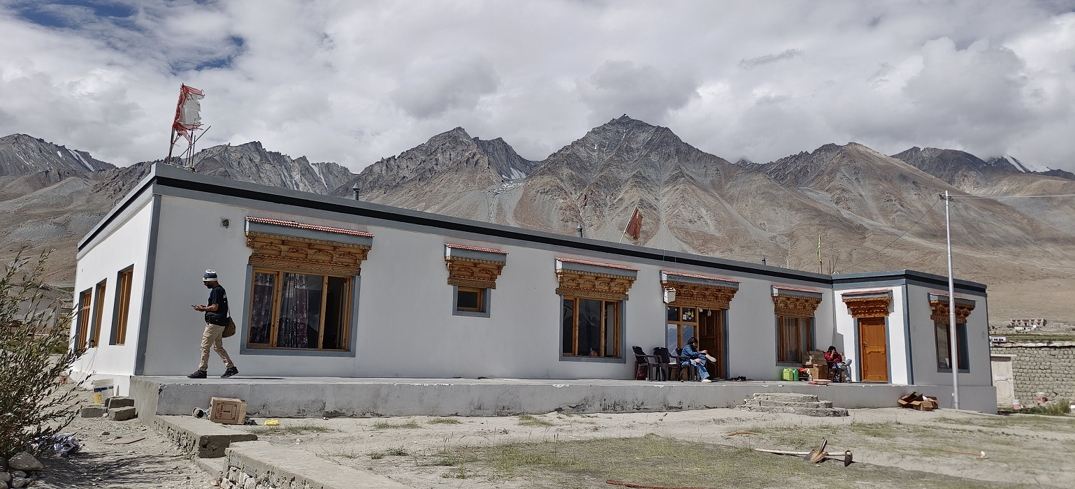
Hanle Monastery: A 17th-century Drukpa Kagyu monastery perched on a hill, offering panoramic views of the vast Hanle River valley.
Wildlife: The surrounding Changthang Wildlife Sanctuary is home to rare species like the Tibetan Wild Ass (Kiang), black-necked cranes, and marmots.
The drive from Hanle to Umling La via Norbu La is the more adventurous, off-road alternative to the standard Photi La route. Covering approximately 88 km one-way, this journey takes about 4–5 hours and is highly dependent on dry weather conditions.
Unlike the Photi La route, which is mostly tarred, the stretch to Norbu La is primarily a dirt track through a high-altitude desert plateau.
The drive from Umling La to Dungti is a highly adventurous and sensitive route that takes you along the Indus River and the Line of Actual Control (LAC). This journey covers approximately 115–130 km and typically takes 6–8 hours due to multiple military check-posts and varying road conditions.
Koyul to Dungti: This stretch runs parallel to the Indus River. You will pass through a vast, silent plateau where you might spot Kiangs (wild asses) and Black-necked Cranes.
Dungti to Loma: From Dungti, you continue towards the Loma bridge, which serves as the main gateway back towards Hanle or Leh. From Loma to Nyoma, 30 km, you cross the Indus River and drive along its eastern bank. This section is partially maintained with occasional bad stretches.From
Nyoma to Mahe Bridge, 25 km, the road remains paved but starts to deteriorate as you approach the bridge. Mahe Bridge to Korzok 60 km, after crossing the bridge and a police check-post, you head toward Sumdo. The road condition from Mahe to Korzok is often reported as poor, with dirt tracks and loose gravel, especially in the final 15–20 km.
The drive from Korzok (Tso Moriri) to Leh via Mahe Bridge is the most direct and fastest route, covering approximately 211–220 km. It typically takes 5 hours under good conditions, as it avoids the high-altitude passes found on the Tso Kar route. This route follows the Indus River for a significant portion of the journey. Korzok to Sumdo 53 km: The initial stretch from the lake is often rough with dirt tracks and loose gravel. Sumdo to Mahe Bridge 16 km, A short transition where the road starts to improve as you approach the Indus. Mahe Bridge to Chumathang 22 km. After crossing the bridge and the mandatory police check-post, you enter the Chumathang valley. Chumathang to Karu is 115 km, with this stretch being mostly well-paved tarmac that follows the river downstream. The final leg, from Karu to Leh, is 35 km and follows the smooth Manali-Leh Highway.
The drive from Korzok to Manali is a roughly 395 km journey that typically takes 10–12 hours of driving time. However, it is usually broken into a 2-day trip due to high altitudes and rough terrain. The most common route connects Karzok to the main Leh-Manali Highway (NH3) at Debring. Karzok to Debring via Tso Kar Lake 130 km. Debring to Manali via Sarchu, Baralacha La, and the Atal Tunnel 265 km.
Price includes
- All ground transportation to & fro as per the itinerary in a comfortable car with an experienced driver.
- 12 nights of hotel, homestay, cottages accommodation at MAP plan.
- Entrance fee at monasteries
- First aid kit with oxygen bottles.
- Mineral water
- Innerline permit for Nubra, Pangong, Hanle & Korzok.
- Goods and services tax.
Price excludes
- Hotel accommodation in Manali.
- Lunch while staying at the hotel and all kinds of snacks.
- Travel insurance.
- Soft or hard drinks.
- Any unforeseen cost arises by natural hazards rain, snow, road block which cost extra lodging & boarding beyond trip Schedule.